
Sept 9 update
While the Thunder Creek fire was estimated to be 200 ha, new mapping data suggests it is only 87.9 ha in size. And, with rain and cooler weather, the chance of the fire making it to Highway 52 has decreased, and the highway is now open.
There are now four helicopters and 27 ground crew working the fire. The ground crew continues to develop guards, as well as directly supressing the fire, while the helicopters continue to bucket water onto hotspots around the edges.
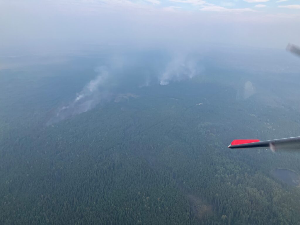
A new photo of the fire shows far less smoke rising than from the photo on Thursday.
Sept 7 Update:
After exhibiting rank five behaviour on Thursday (which includes a fast moving crown fire and spot fires starting ahead of the fire), the Thunder Creek fire has calmed down, and, as of the last report by BC Wildfire, was exhibiting rank two behaviour (which is a slower burning surface fire, with little to no candling) as of Friday.
However, today is expected to get quite warm and windy, and conditions could lead to more vigorous behavior later in the afternoon.
The fire is still moving east towards Highway 32, which remains closed between the Kelly Lake Road and the Hiding Creek Forest Service Road.
There are now 30 firefighters working on the fire, establishing road access to the fire and establishing a machine guard to prevent the fire from growing to the south. They are also working on building a machine guard along highway 52, to make it harder for the fire to cross.
There are also three helicopters and an airtanker working to slow fire growth, dumping retardant and water along the edges of the fire.
While there are no structures in immediate danger from the fire, BC Wildfire has launched a full response to deal with the fire.
As of 11 am, the fire was still estimated to be 200 ha in size.
Sept 6: Original story
The fire east of Bearhole has blown up grown (edit note: blown up is a technical term, typically reserved for rank 6 fires, that I am far too fond of using when a fire grows quickly, in this case from 13 ha) to 200 ha.
It has forced the closure of Highway 52E between the Redwillow/Hiding Creek road and Kelly Lake Road.
That means the Boot Lake road to GP should be off limits, too. Not sure what Wildfire is doing to control traffic, but just be forewarned.
There are currently no evacuations orders or alerts associated with this wildfire.
The fire is now being called the Thunder Creek Wildfire, numbered G72443.
At last report, there were still two helicopters on site, as well as five pieces of heavy equipment.
According to the Peace River Regional District, “good progress” was made overnight through air response. “Crews are continuing air response today with ground crews also attending the fire.”
BCWS has advised that at this point, the fire is likely to be contained and do not foresee any area restrictions, alerts or orders being necessary. As always, this is weather dependent and subject to change.

Trent is the publisher of Tumbler RidgeLines.